

Los Nevados National Park, Colombia:
The Ultimate Backpackers Travel Guide
+ Quick Links
An Introduction To Backpacking Los Nevados National Park
Los Nevados National Park: Points of Interest
Our Map of Los Nevados National Park
Los Nevados National Park: Self-Guided Treks
Los Nevados National Park: Guided Treks
Los Nevados National Park: Packing List
When is the Best Time to Visit Los Nevados National Park?
Where Next?

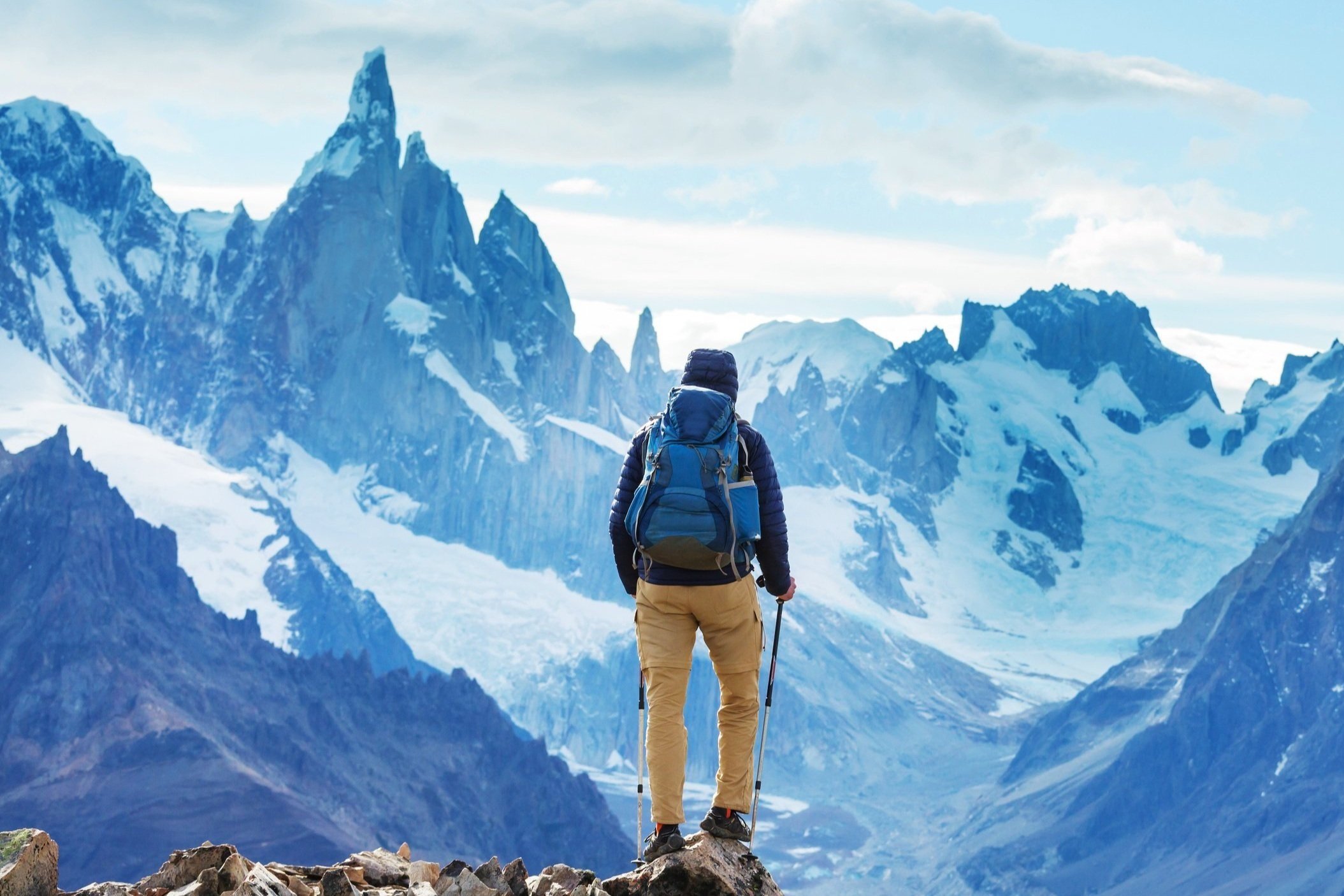
An Introduction to Backpacking Los Nevados National Park, Colombia
Los Nevados is Colombia's third largest and third most popular national park.
The area is a hiker's dream, crammed with unique ecosystems, towering volcanoes, glaciers, lakes, and more.
Here, evolution takes place faster than anywhere else on Earth. You'll find rare and endemic fauna in the park's confines. Most notably, you'll spot hundreds – if not thousands – of the endangered Frailejone plant. Natural sponges, Fraillejone are only found in 2% of Colombia, yet the areas where they reside produce around 85% of the country's drinking water.
The park is also home to various wildlife. Though generally, they keep their distance from humans. If you're lucky, there is a chance of spotting Andean Condors – the largest avian species in the world, spectacle bears, cougars, tiger cats, and mountain tapirs.
Eight volcanoes are found in the park, some active and some dormant. Three of the eight volcanoes are glaciers, something you probably wouldn't have expected in Colombia with its tropical climate.
Crossing the glaciers is a highlight of any expedition to the National Park, partially because of their limited longevity. Due to the effects of climate change, scientists predict that Colombia's glaciers will disappear by 2048. At Nevado Santa Isabel, this change is felt keenly. The glacier has receded by 80% in the last 30 years, and it's widely expected to disappear within the next ten years.
The entrance fee for Los Nevados' pristine landscapes is 53,000 COP. The park is a delicate ecosystem susceptible to human disturbance. So be mindful of your actions and their impact throughout your visit; no littering or campfires.
A guide isn't compulsory throughout the park. However, it does come highly recommended, and some areas are inaccessible without one due to safety reasons. Entry via Salento and Valle de Cocora is the only point you can get into the park without a licensed guide.
Disclaimer: This article may contain affiliate links, and we may earn a small commission should you use them, for which we are incredibly grateful. However, the recommendations are still our own and intended to advise on the best possible adventure in Los Nevados.

Backpacking Los Nevados National Park, Colombia: Points of Interest
Volcán Nevado del Ruiz
Latitude 4º53’9.89” North, Longitude 75º19’0.49” West – Altitude: 5,330 Metres.
Nevado del Ruiz, found in the park's northern sector, is the highest point in Los Nevados. Unfortunately, the volcano, and much of the surrounding area, are off-limits due to volcanic activity. Nevado del Ruiz has erupted in recent memory, with catastrophic consequences.

On the 13th of November 1985, the volcano erupted. The ensuing mudflow destroyed the nearby town of Armero, killing 22,000 residents. It was the most deadly volcanic eruption since records began.
If you're exploring the park with a guided tour, certain areas around Nevado del Ruiz will be open to you. Though only at certain times of the day. If you're going solo, avoid the volcano, it's not worth the risk.
Laguna Verde Encantada
Latitude 4º49’44.88” North, Longitude 75º20’48.20” West – Altitude: 4,296 Metres.
If your Spanish is a little rusty, you may not have guessed it from the name. But this placid lake is a stunning emerald green color.
The lake is found in the park's northern quadrant, facing restrictions due to Volcán Nevado del Ruiz's volcanic activity. Typically, reaching Laguna Verde Encantada will only be available via a guided tour following Camino 2. These tours operate from nearby Manizales and Pereira rather than Salento.
Paramillo Del Cisne
Latitude 4º50’34.92” North, Longitude 75º20’47.37” West – Altitude: 4,628 Metres.
Paramillo del Cisne sits in the outer reaches of Los Nevados’ northern sector. Although seismic activity has been detected recently, the stratovolcano is believed to be dormant.

Due to the effects of global warming, the perpetual snowline that once covered the summit is now seasonally snow-capped. Hence, the site's name changed from 'Nevado del Cisne' to 'Paramillo del Cisne' in the 1960s.
With the landmark located in the national park's northern sector, visitations are restricted, though still accessible via a guided tour from either Manizales or Pereira.
Volcán Nevado Santa Isabel
Latitude 4º48’22.57” North, Longitude 75º22’17.17” West – Altitude: 5,100 Metres
Nevado Santa Isabel is a volcano found outside the national park's prohibited zone. It's one of the three glaciers found in Los Nevados and one of the last tropical glaciers on Earth – though it's unlikely to exist ten years from now.

The summit of Santa Isabel is one of the most accessible in the national park. It can be completed in just two days with minimal experience, though a guided tour to reach the summit is still recommended. Reaching the summit of Santa Isabel is a sure-fire highlight of visiting Los Nevados.
If venturing through the park without a guide, you can reach the foot of the volcano via Camino 17 or Camino 2.
Paramillo Santa Rosa
Latitude 4º47’58'.70” North, Longitude 75º27’30.60” West – Altitude: 4,965 Metres
Paramillo Santa Rosa is a stratovolcano representing the most westerly volcano in the national park. Up until the '70s, the volcano possessed a permanent snowcap. However, due to the effects of global warming, its ice cap has disappeared, and powdered snow only appears at the summit seasonally.
The volcano is considered dormant, with no activity being recorded to date.
Surrounding the volcano's base are several hot springs, a major attraction in their own right and one that draws visitors to the volcano.

If trekking to Paramillo Santa Rosa, you'll have to wander far from the well-established paths of the national park. As such, we'd only recommend visiting through a guided tour – unless you consider yourself a seasoned hiker.
Laguna del Otún
Latitude 4º40’49.14” North, Longitude 75º21’48.95” West – Altitude: 4,000 Metres
Marking a convenient halfway point between Volcan Nevado Santa Isabel and Paramillo Santa Rosa, Laguna del Otún is an excellent basecamp for exploring some of Los Nevados' highlights and is a stunning attraction in its own right.

The lake is glacial in origin and fed by the thawing of Santa Isabel's ice cap. The lake spans 1.5 square kilometers and is home to rainbow trout, a local delicacy. With recreational fishing permitted (within reason), a night camping at the lake and dining out on some freshly caught trout is a fine way to wind down after a day of strenuous trekking.
The lake is easy to get to, regardless of whether you're trekking solo or following a guided tour; just follow Camino 19 to arrive at the lake.
Laguna del Encanto
Latitude 4º40’49.14” North, Longitude 75º21’48.95” West – Altitude: 3,980 Metres
Laguna del Encanto is straightforward to find, nestled at the intersection of Camino 15 and Camino 19.
This small lake is located in close vicinity to Nevado del Tolima. It is a perfect stopover point should you prefer camping to a night at one of the nearby Fincas.
Volcán Nevado del Tolima
Latitude 4º39’27.34” North, Longitude 75º19’44.21” West – Altitude: 5,280 Metres
The second highest peak in the national park. Nevado del Tolima is a volcano that looks just as your childhood self would imagine – a perfect and iconic cone shape.
Volcanic activity hasn't been detected here since 1943. Reaching the summit is probably the most popular activity in Los Nevados – though it is challenging. With an incredibly steep incline, reaching the summit is regarded as one of Colombia's most demanding and technically difficult treks.

If you're fortunate enough to cough up for a guided tour to the summit, the expense is well worth it. Watching the sunrise above the park's other volcanoes, sitting 5.25 kilometers above sea level, is a surreal experience.
If you're exploring the park without a guided tour, don't – and this can't be stressed enough – attempt to climb to the summit of Nevado del Tolima. It's a dangerous endeavor where many things can go wrong. Instead, circle the volcano's base, where you'll encounter thermal springs and stunning lakes.
If you are hiking solo, circling the volcano will see you follow Camino 6, Camino 13, Camino 14, and Camino 15.
Paramillo del Quindío
Latitude 4º42’56.69” North, Longitude 75º23’18.30” West – Altitude: 4,690 Metres
Distinct from the other volcanos of Los Nevados, Paramillo del Quindío is a dormant stratovolcano located near the center of the park, with a peak consisting of brightly colored sand.

Climbing to the summit, over four-and-a-half-thousand meters above sea level, is doable if trekking solo or with a guide.
If you're exploring Los Nevados without a guide, you'll need to follow Camino 16 to reach the volcano's base.
Our Map of Los Nevados National Park, Colombia

Backpacking Los Nevados National Park, Colombia: Self-Guided Treks
We're big lovers of hiking solo and being free to explore any given area without the constraints of following a tour. If you share that sentiment, you'll be delighted to know that traversing this incredible area without a guide is permitted, though only in certain regions.
There are a couple of need-to-knows for those who want to venture out into Los Nevados without a guide.
First, wild camping is permitted, though only in certain areas; for the most part, that excludes the northern sector of the park nearby Nevado del Ruiz. With accommodation at Finca's sparse and with no guarantee of a bed for the night, camping may be essential to your trip – pack accordingly.
Secondly, keep a GPS handy or your phone charged – the trails aren't always well marked.
Finally, it should be no surprise that food is seldom found in the park. Make sure you stock up on enough to see you through the duration of your hike before departing.
Trail 1
Covering 48.5 kilometers over 4-5 days, this trail begins in Valle de Cocora before ascending into the Paramo of Los Nevados en route to Nevado del Tolima. After circling around the giant volcano, you'll head back to the entrance of Valle de Cocora.
Along the way, you'll pass stunning scenery, small lakes, and bathe in thermal springs at the foot of the second-highest point in the national park.
Day 1
The first day of this trek is punishing. You'll cover around 14.5 kilometers and climb 1,300 meters, taking around seven and a half hours. An early start is essential. You should be aiming to catch a Willy Jeep from Salento at first light.
The entrance to Valle de Cocora marks the start of this solo expedition into the heart of Los Nevados. From the entrance of this luscious valley, you'll begin walking towards the Reserva Acaime hummingbird sanctuary, following the Camino 5 trail.

Upon reaching the hummingbird sanctuary, stop for a quick break and refreshments. Though it'll cost you around 5,000 COP, try the local specialty – hot chocolate with a block of cheese for dipping (not as gross as it sounds, promise).
From the Acaime hummingbird sanctuary, you'll continue onwards, making your way towards Estrella de Agua, which marks the gateway to the national park. Once past Estrella de Agua and with your 53,000 COP park entrance fee paid, follow the Camino 5 trail up towards La Primavera, a possible stop for the night.
Some travelers have reported that the owner of Finca La Primavera does not take too kindly to solo hikers. If this isn't the case for you, a dorm bed at the Finca will set you back 20,000 COP for the night.
If you feel unwelcome at Finca La Primavera, 1.5 kilometers up the road is alternative accommodation called Finca La Playa Aquilino. Here, a dorm bed for the night will also cost 20,000 COP.
Day 2
Day one was tough. You navigated a long trail, a steep ascent, and tricky – often muddy – terrain.
Day two of your adventure into the Los Nevados national park isn't half as demanding. In fact, you can afford to sleep in. Consider it a reward for your hard work the previous day.
Today, you'll cover 6.5 kilometers. That is if you stayed the night at Finca La Primavera. The distance is slightly less if you stay at Finca La Playa Aquilino.

Upon departing for the next leg of your trip, you'll cross from the end of the Camino 5 trail and onto Camino 19. Your destination? The peaceful Laguna el Encanto, near the base of Nevado del Tolima.
This leg of the trip should take you three hours at most, climbing a further 900 feet on your way to the lagoon. While this leg of the journey is far from strenuous, it is the perfect chance to rest after an arduous first day. The easy-going hike will give your body the chance to acclimatize to the altitude and give you a chance to really soak up the paramo landscape.
Once you reach Laguna el Encanto, it's time to set up camp for the evening and get some rest before a more challenging third day.
Day 3
Waking up to – what is hopefully – a magical paramo sunrise on day three, you should feel well-rested for the 16.5-kilometer journey ahead.
On day three, you'll depart Laguna el Encanto and circle Nevado del Tolima, encountering several thermal springs. Though this is the longest leg of your journey, you won't gain much altitude. Because of this, you can expect the day's journey to take around six hours.

You'll continue following the Camino 19 path from Laguna el Encanto until its endpoint. After leaving the Camino 19 trail, you'll proceed to Camino 6, at the end of which lies the Termales Cañón hot springs.
The hot springs make for a welcome halfway point on the third day of the hike. After taking a dip in the springs, it'll be time for you to move on, following Camino 14 and then Camino 15 back to Laguna el Encanto. Arriving at the lake, it'll be time to set up camp for the evening.
Day 4
On day four, you'll face a 21-kilometer dash back down to the entrance of Valle de Cocora. Though that length probably seems daunting, you'll find it much easier than the route into the national park. After all, you won't have to contend with the increasing altitude as you descend 1,700 meters.
Walking back, you can expect the journey to take between six and a half to seven hours. From Laguna el Encanto, you'll be following Camino 19 up until you reach Finca la Primavera.
Once you reach the Finca, you'll switch paths, moving on to Camino 5 as you make your way to the park exit. Upon reaching the exit, you have a choice to make.

You can either stick to Camino 5 back to Valle de Cocora, following the same route you entered Los Nevados from. Alternatively, you can switch paths and make your way to the entrance of Valle de Cocora via Camino 1.
The latter will chop nearly three kilometers from your journey. However, following Camino 5 does lend an air of familiarity and offers you the chance to stop for a quick break and a drink at Acaime hummingbird sanctuary.
With the final Jeeps departing from Valle de Cocora to Salento at 5 PM, you'll need to be up bright and early to avoid the long walk back to Salento. We'd recommend departing from Laguna el Encanto at 8 AM.
Our Map of Route 1
Trail 2
This second and considerably longer route through Los Nevados suits those looking for a challenge. The trail sees you start at Valle de Cocora before covering 83 kilometers over a week.
During your week-long expedition, you'll pass the famous Valle de Cocora before ascending into Los Nevados' stunning paramo ecosystem. You'll circle around Nevado del Quindio, passing the incredible Laguna del Otun, Laguna el Encanto, and thermal springs. All while basking in the incredible landscapes of the national park.
Day 1
Much like the first day of route one, you'll start your journey into the national park from the entrance of Valle de Cocora. You'll walk along Camino 5 up towards the Acaime hummingbird sanctuary, stop for a rest and refreshments, and continue towards the entrance of the Los Nevados national park.

Upon reaching the entrance to the park, you'll change paths, moving onto Camino 19. Keep moving until you reach a stop for the night at one of Finca la Primavera or Finca la Play Aquilino. As mentioned in the first trail, the lady who runs Finca la Primavera can be a bit of a dragon if you turn up without a guided tour. Finca la Playa Aquilino, found 30 minutes down the road, is a safer bet for more hospitality. A dorm bed at either of these properties will cost 20,000 COP.
This first leg of the trail sees you cover between 14.5 and 16 kilometers – depending on where you rest your head for the night – and climb 1,300 meters. The journey should take around 7 hours, so an early start is essential.
Day 2
On the second day of your expedition, you'll cover an additional 21.4 kilometers. Your destination? Finca Africa.
Covering an additional 21.4 kilometers may sound pretty daunting. However, elevation gain on the second day of your trek will be minimal. You should be able to complete this section in around seven hours.
Departing from either Finca, you'll continue to follow the Camino 19 path towards the towering Nevado del Tolima. Around 6.5 kilometers into your journey, you'll arrive at Laguna el Encanto near the foot of the towering Tolima. Be sure to take a quick break when you reach the lake.

After your brief stop at Laguna el Encanto, it's time to get back on the trail and continue following the Camino 19 path. For a time, you'll be walking parallel to the Río Totare. After that, you'll have naught but the surrounding paramo for company until you reach Finca Africa.
Once you arrive, it's time to set up camp for the evening.
Day 3
After two days of intense hiking, you'll be relieved to know that the third day of your Los Nevados trek is considerably easier.
After departing from Finca Africa, you'll spend about five hours trekking 10.5 kilometers to Laguna del Otún. Once again, you'll be following Camino 19 for the duration of your third day, climbing 600 meters higher in the process.
At the end of this leg of your trek, you'll arrive at Cabaña Otún, an accommodation site run by the national park. You can set up camp here for just 10,000 COP, and the site is equipped with public toilets, showers – albeit freezing cold, and a kitchen where you can prepare a decent meal.

After freshening up and providing you have the energy, walk to Mirador Laguna Otún, a viewpoint from which you can see the entire lake.
From Cabaña Otún, the hike to the Mirador is 4.5 kilometers, and you'll climb 200 meters before returning. With no heavy backpack to weigh you down, reaching the viewpoint should take about an hour and fifteen minutes. In contrast, the reverse climb back down to the park accommodation should take you no more than an hour.
If you opt to climb to the Mirador and back, dinner, consisting of freshly caught trout from the lake, will be ready by the time you return to camp.
After a hearty meal, it'll be time to hit the hay and get some rest before day four.
Day 4
Day four of your trek into Los Nevados will be the easiest. You'll need the rest before day five.
On your fourth day, you can afford to sleep in later before departing Laguna del Otún for a 10.5-kilometer hike along Camino 19 to your next checkpoint, Finca Berlin.

Departing from Laguna del Otún, the journey to Finca Berlin will take around three and a half hours. Once there, it's time to set up camp for the evening.
Day 5
Your fifth day is a biggy. After all, you're about to climb to the top of a volcano. You'll want to be up at first light.
Departing Finca Berlin, you'll continue following Camino 19 for about 6.5 kilometers before reaching a fork in the path. One path continues following Camino 19. The other takes you on to Camino 5 and towards Paramillo del Quindio. Pursue Camino 5.
As you edge closer to Paramillo del Quindio, the landscape around you will change drastically. The dark green hues of the paramo will give way to earthy tones consistent with that of the uniquely sandy volcano. Climbing a further 800 meters to the summit will take some time, but the view from the top is so worth it.
After reaching the summit of this eerily Martian landscape, it's time to climb back down to the foot of the dormant volcano and rejoin the Communa 5 trail. Once you rejoin Camino 5, you'll retrace your steps until you arrive on Camino 19.

Returning to the Camino 19 trail, you'll continue to follow it away from Finca Berlin. Eventually, you'll arrive back at the national park entrance. Once you arrive at this point, make your way back towards Finca la Primavera or Finca la Playa Aquilino to rest up for the night in an actual bed.
As was the case upon entering the park, your bed for the night will cost 20,000 COP. This section of your trek covers 22.1 kilometers, climbing 880 meters to the summit of Paramillo del Quindio before descending 954 meters back down to your bed for the night. In total, day five will take between ten and eleven hours; good thing day four was easy, and you took the time to rest up.
Day 6
After six days of wondering the Los Nevados national park, you're probably knackered. Your clothes smell a bit, you're desperate for a good meal, and you can't wait to return to your hostel's warm embrace. As extraordinary as this national park is, we don't blame you.
On your hike's sixth and final day, you'll retrace your steps along Camino 19 until you reach the park entrance. Once there, you have a decision to make.

At the park entrance, you can choose to make your way back down to the entrance of Valle de Cocora via Camino 5 – the route you initially took into the park. Alternatively, you can turn off to follow Camino 1, a shorter, albeit unfamiliar, route.
Either way, your final day in Los Nevados will see you cover between 14.5 and 16 kilometers – depending on where you slept for the night. This last leg of your trek will take you around five hours. This will leave you with time to have a lie-in after the most challenging day of the hike while still getting back to Valle de Cocora in time to catch the last Jeep back to Salento.

Backpacking Los Nevados National Park, Colombia: Guided Treks
Guided Tour One – Nevado del Tolima summit
This guided tour lasts four to five days – depending on how you cope with the altitude. You'll climb through Valle de Cocora towards the park entrance before proceeding to the picturesque paramo ecosystem. The highlight of the tour is, of course, the climb to the summit of Nevado del Tolima, 5,250 meters above sea level.
The tour is run by an organization called Project Cordillera. An award-winning tour agency of entrepreneurs, travel experts, and development professionals dedicated to collating the best experiences in the Andes.
On the first day of your expedition, you'll meet your guide for breakfast in Salento before proceeding to Valle de Cocora. Once there, you'll begin the hike past the wax palm trees and cloud forest toward the Los Nevados national park entrance. Arriving at the park entrance, you'll proceed through the moor, following Camino 19 until you reach Finca la Primavera, your stop for the night.

Waking up for the second day of your trek, you'll have breakfast at Finca la Primavera before moving on towards your second campsite, located under the shadow of the dormant volcano. You'll climb to 4,500 meters above sea level, passing Laguna el Encanto along the way.
On the third day of your trek, you'll rise at dawn to begin the challenging climb towards the summit of Nevado del Tolima. It will take roughly two hours to climb to the summit, 5,240 meters above sea level. With the early start, if you're lucky, you'll arrive at the top to catch a spectacular sunrise over the rest of the park. After reaching the summit, you'll climb back down to the volcano's base and towards Finca la Primavera, where you'll camp for the evening.

The final day of your tour sees you depart Finca la Primavera and begin the descent back down to Valle de Cocora. The descent sees you take an alternative path to the one you took towards the Los Nevados park entrance. This new trail promises a fresh perspective on the mystical cloud forest. When you finally arrive at the entrance to Valle de Cocora, you'll be transported back to Salento via Willy Jeep, buoyed with memories that will last a lifetime.
No doubt about it, this tour is expensive – priced at 1,275,000 COP. However, the only way to reach Nevado del Tolima's summit is worth every peso. The tour price includes accommodation for the trek, a certified English-speaking guide, three meals a day prepared by a professional outdoor cook, all park entrance fees, and the technical equipment required to climb to the Tolima summit.
Guided Tour Two - Santa Isabel Summit
Run by the well-reviewed Montañas Colombianas tour agency, this two-day trek sees you climb to the summit of the fast-melting Santa Isabel glacier. Santa Isabel is one of the few remaining tropical glaciers on the planet.
For this two-day tour, you'll depart at 6 AM from the city of Perreira. If you're based in Salento, you can reach Perreira by bus for 5,000 COP; the journey will take about 40 minutes. Alternatively, you can catch a taxi to Perreira, which will cost 55,000 COP.
You'll depart from Pereira on a 4x4, driving for 2.5 hours through the Andean forest towards the park, stopping at 3,850 meters above sea level. Once dropped off, park officials will sign you into Los Nevados before you proceed on foot to the nearby refuge of El Cisne, located 4,100 meters above sea level.

After reaching El Cisne, you'll have breakfast before beginning an hour-and-a-half walk towards Laguna Verde to acclimatize to the altitude. Upon reaching Laguna Verde, you'll begin the walk back towards the El Cisne refuge, where you'll be given a talk about the technicalities surrounding the impending climb to the Santa Isabel glacier. After the talk, you'll have dinner and get a very early night.
The second day of the trek begins at 1:30 AM. After a hot drink, some fruit, and some energy bars, you'll be driven out towards the edge of the glacier.
Once dropped off, you'll hike four kilometers along a well-trodden path, with headlamps guiding the way. You'll spend roughly two-and-a-half hours climbing to the glacier's summit and should arrive in time for sunrise. From your vantage point, you'll be able to appreciate the sun climb above Nevadio del Ruiz, Tolima, and Paramillo Santa Rosa in the distance.

After appreciating the beauty of your surroundings, you'll head back down to the foot of the glacier. Once you arrive at the vehicle, you'll be driven back to the El Cisne refuge. There, you will have lunch before being driven back to Pereira.
Expect to arrive back at Pereira at 6:30 PM.
The tour to Santa Isabel's summit is pretty short, reflected in the tour's price, 699,000 COP. The price includes entrance to the national park, three meals a day, snacks and hot drinks, technical equipment to climb the glacier, transportation to and from Pereira, medical insurance, and a certified English-speaking guide.

Backpacking Los Nevados National Park, Colombia: Packing List
The Essentials
Tech
Clothing - For Men
Clothing - For Women
Toiletries
Miscellaneous

Backpacking Los Nevados National park, Colombia: When Is The Best Time To Visit?
The weather in Los Nevados is temperamental at best. Officially, the dry seasons here stretch between December and February and July through to September. Even then, it's not uncommon to experience bright blue skies, overcast drizzle, pouring rain, and snowfall in a single expedition.
The park has a strict limit on the number of official visitors. Though solo hikers may be entering through Salento, they are few and far between, with the riches of Los Nevados very much under the radar for now.
Temperatures in the national park fluctuate wildly, given the altitude. Expect 14ºC at best and -3ºC at worse. Be sure to pack appropriately. A t-shirt and shorts won't cut it here.
Where Next?

Bogotá
Capital Region

Salento
Zona Cafetera
You Might Also Like

Travel Insurance
The reality of travel isn't what you see on an Insta feed or in a Lonely Planet guide. Things go wrong, and shit hits the fan when they do. Find out why you need travel insurance, what it covers, costs, and where to get it.

Colombia Travel Tips
Is Colombia Safe? What’s Colombian food like? How do I get around? What’s the visa situation? Do I need any vaccinations to visit Colombia? Get the answers you’re looking for and lots more on our Colombia travel tips page.
Ultimate Packing List
Packing for South America can be a nightmare. It's a huge continent, with many countries and climates to plan for. Our packing list covers the budget backpacker, the frugal backpacker, the flashpacker, and the digital nomad.
